Op-Ed: What will it take for Houston to become more 'resilient'?
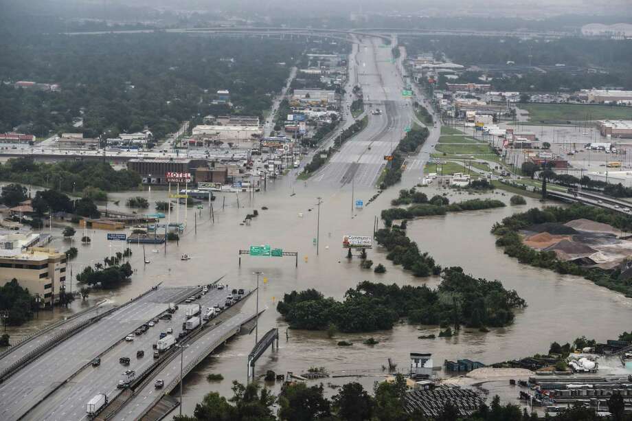
If the Houston region wants to minimize the human impacts of future events like Hurricane Harvey, we need to think about flooding differently.
Houston City Council recently approved the creation of a municipal utility district to support building 900 homes in Spring Branch on the former Pine Crest Golf Course. These homes will be in a floodplain, in a neighborhood that has flooded repeatedly. This subdivision is designed to minimize flood risk for the new homes. But what can be done to help the hundreds of existing flood-prone homes around it?
If we want to be more resilient, we should take a more holistic approach. Our goal should be to address existing flooding risks, not merely to make new development flood resistant while not making existing issues worse.
Spring Branch is typical of a lot of neighborhoods in Houston. The natural drainage has been straightened and lined in concrete, and homes are built right up to the narrow channel. When there is an event like Harvey, the water has no place to go but into people's homes, many of which were built low to the ground and flood easily.
In such a place, the options for reducing flood risk are limited. Widening channels requires massive right-of-way acquisition and displacement of residents, and elevating all the surrounding homes is prohibitively expensive.
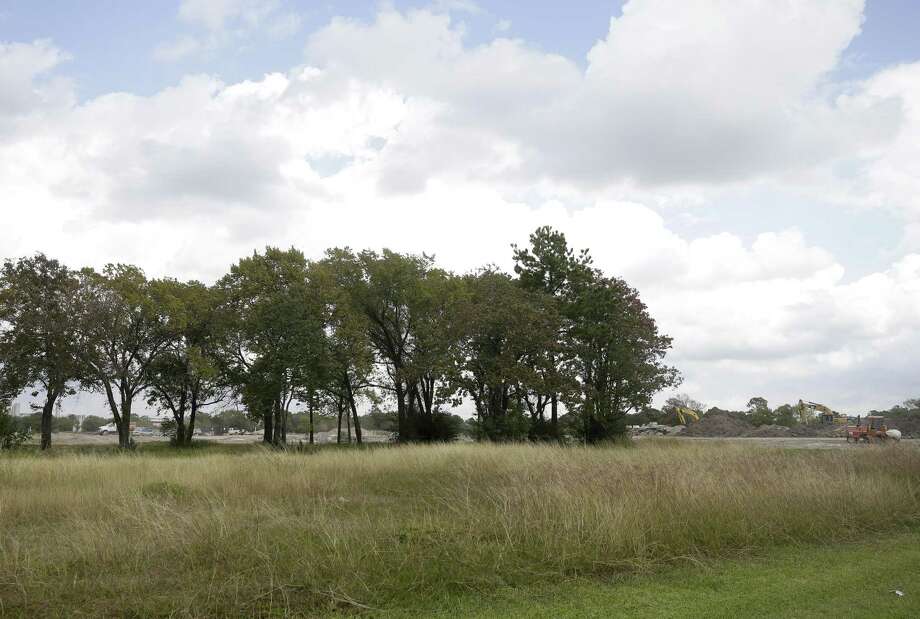
However, a large available site – think 25 acres or more – offers the opportunity to build a new regional detention basin. These basins can store floodwater, then release it slowly after a storm. There are areas where these basins lower floodwater by several feet. There are not many sites big enough for these types of basins, but there are some, and sometimes they become available for redevelopment.
How can we take advantage of such opportunities?
First, we need to understand all our waterways. Pine Crest, for example, is located on Brickhouse Gully, a flood-prone tributary of White Oak Bayou. There are many similar tributaries across the region – Cole Creek in Fairbanks, Little White Oak Bayou in Independence Heights and Acres Homes, Keegans Bayou in Alief and the branches of Berry Bayou in Edgebrook.
These kinds of tributaries have not been fully studied in the major federally funded bayou flood infrastructure projects, which focus on the main channels. Nor have we studied localized flooding in older neighborhoods, where, unlike in newer developments, the streets were not designed to carry water.
In heavy rain events, water flows cross country, down streets and through backyards. Where detailed modeling has been done to understand these flows, we've discovered that actual floodplains are far greater than those FEMA has mapped. Without those studies, we can't quantify the flooding issues or identify potential problems. The Harris County Flood Control District (HCFCD) and the U.S. Army Corps of Engineers have the expertise to oversee these studies if resources were to be identified and allocated to do so.
Second, public agencies could track available sites, be they golf courses in southwest Houston, used car lots in Acres Homes, truck yards along the Gulf Freeway or undeveloped land on Cypress Creek. When these privately owned properties come up for sale, public agencies should be among the first to know.
In some cases, it could be beneficial to acquire these properties in their entirety, in other cases, it might make sense to integrate public flood mitigation infrastructure into a private project. Similarly, when any public property – a park, a school, a community center or a highway – is rebuilt, it should be evaluated to see whether flood mitigation infrastructure can be part of the project. The HCFCD knows how to do that – and has already built regional detention in city parks – but it requires resources for studies and cooperation from other public agencies.
Third, funds must be available to purchase these sites. Capital programs are budgeted years in advance, but that doesn't work when a seller is impatient and developers are ready to make offers. Private nonprofits like the Houston Parks Board have been able to act on such opportunities to acquire land for parks and greenspace. Public funds could be set aside expressly for acquiring land for flood mitigation, so public agencies can act quickly when opportunities arise.
In watersheds across the region, there are properties which will become available this year, next year and the year after. With planning and coordination, agencies can identifywhichonespresentprime opportunities to mitigateflooding,and make sure they are acquired by the public to benefit the public.
In Houston, every project built – public or private – can be an opportunity to reduce flood risk and the impacts of future storms on residents and businesses. Instead of simply asking that a new development, new public facility ornewpieceof transportation infrastructure not make flooding worse, we should ask how it can help reduce flooding and the effect and consequences flooding has on people's lives.
Christof Spieler is project manager for the Greater Houston Flood Mitigation Consortium and vice president at Huitt-Zollars. Read the consortium's recent Flood Mitigation report.
The Greater Houston Flood Mitigation Consortium is funded with generous support from Houston Endowment, Kinder Foundation, and The Cynthia & George Mitchell Foundation.
NEWS
Hide Full Index
Show Full Index
View All News